
The story of the harbour control of Rotterdam.
The city of Rotterdam is located 30 km from the North Sea. Its maritime access is through the delta formed by the Rhine and the Meuse.
Its port is currently the most important port in Europe. To get there, the Dutch had to carry out a gigantic task.
Here is a summary of the history of this port and the evolution of navigating it's harbour.
The beginnings of navigation in the delta.
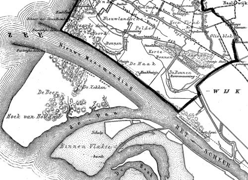
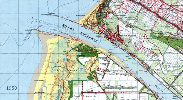
A map from 1673 shows the delta formed by the two rivers. The sea passage to Rotterdam is through the mouth of the Meuse and passing to the north of the island "Voorn Putten".
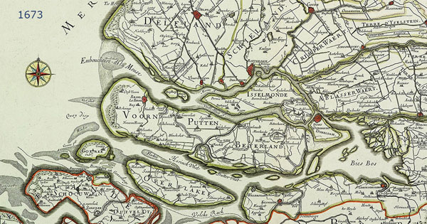
Maasmond 1673.
During this time harbour navigation was made using :
- the church of Goedereede. This small town is located on the island of Gorée. From 1552, coal is burned.
- The tower of the church of Brielle which also served as a beacon from 1759 to 1850.
- A stone tower, "Stenen Baken" dating from 1630 and currently restored, served as a landmark for the entrance to the mouth of the Meuse. It is part of an alignment with the church of Brielle.
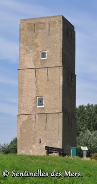
Stenen Baken.
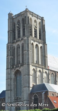
Church of Brielle
Church of Goedereede.
The first works.
Unfortunately, deep-sea vessels often had difficulty navigating the harbour mouth due to shifting sandbars which made access to the harbour increasingly difficult.
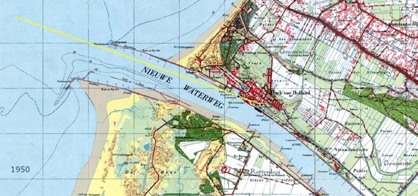
After 5 years of study, a project was developed to build a new 15 km waterway, the "Nieuwe Waterweg". It is a large canal dug in a straight line cut into the land.
The study was finalized in 1864 and work began in October 1866. The first ship used the new channel on 12 July 1872.
Nieuwe Waterweg Gemeenteatlas 1866-1870.
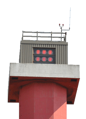
The marking of this new route was not sufficient. It consists of an iron hexagonal tower with a white light indicating the north and a red port entrance light indicating the south. Another makers was placed on Beer Island, south of the new shipping lane.
The increasing number of strandings and accidents forced the authorities to design a new navigation system. This consisted of marking the entry into the Waterweg and another for its exit. The two plans below show the new navigation markers.
Entrance line of the Nieuwe Waterweg.
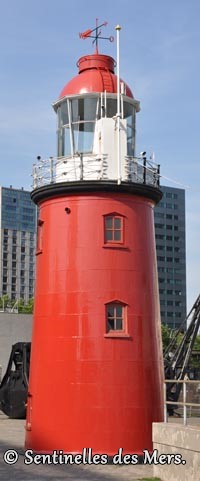
The front light was built in 1893. This small stone building was commissioned in 1894. It is replaced by a 14 m cast iron tower. This tower was lit on December 31, 1900.
It is located in Berghaven.
The first light made of cast iron is currently located at the entrance to the Maritime Museum in Rotterdam.
Description of the light.
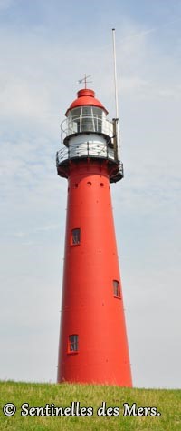
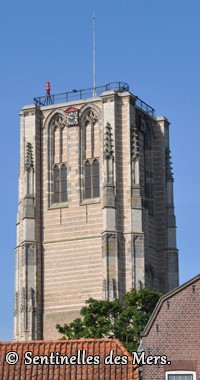
The rear light was also made of cast iron. This 26.5 m tower is lit on February 14, 1894.
This lighthouse is no longer in use but still exists.
Description of the light.
Exit alignment of the Nieuwe Waterweg.
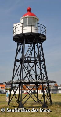
To mark the exit lane of the Nieuwe Waterweg, two lighthouses of metal construction were used. They were put into service in 1894 - 1895.
The rear light is located near the Boulevard Reine Emma (Berghaven) and the second near the front light. The new extension phase of the port made these lights obsolete.
They were deactivated in 1967. The rear light was destroyed by fire and the front light was moved to the resort of Kuikduin where it served as a tourist attraction.
Description of the rear light.
The Europort.
The Netherlands wanted the port of Rotterdam to be the centre of the petrochemicals industry and extending the port was needed to create the new infrastructure required to achieve this goal.
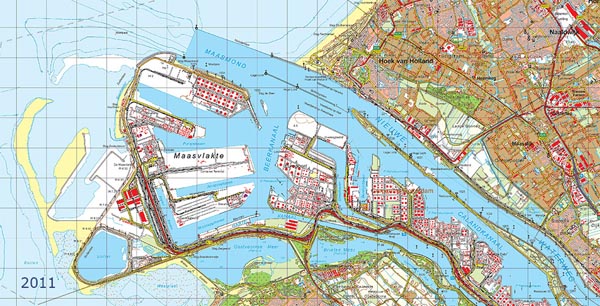
Europort and Maasvlakte 2011, in yellow the extension of Maasvlakte 2.
The Europort (Gateway to Europe) was built between 1958 and 1964.
This extension was made south of the Nieuwe Waterweg. The Calandkanaal was dug to allow oil tankers access to this new port.
The expansion of the port did not stop there. From 1965, two new ports were constructed. They are named the Maasvlakte (plain of the Meuse) and the Maasvlakte 2.
These two ports are valuable additions to the harbour.
In line with the Delta Plan, two mobile dams were built to prevent flooding, the first will close the Nieuwe Waterweg and the second will close the Hartel Canal.
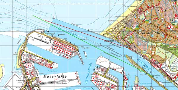
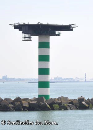
The 3 alignments of access to the Europort.
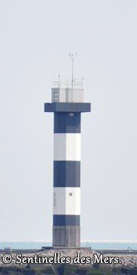
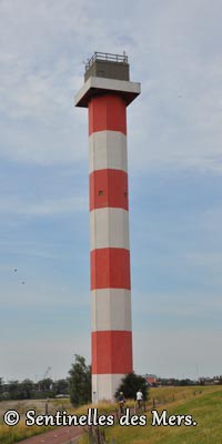
New port markings were required and three new markers and two new port entrance lights were constructed. A new lighthouse was also built on the Maasvlakte and the old light was discontinued.
The 8 towers are made of octagonal concrete blocks. They all resemble each other except the colors and heights.
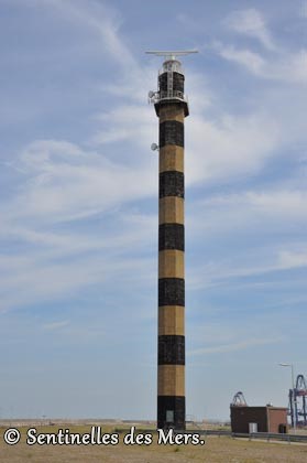
The lighthouse is also made of concrete and octagonal in shape. It will be the highest lighthouse in the Netherlands. With the completion of the Maasvlakte 2 extension, the old lighthouse became obsolete and was discontinued in 2008.
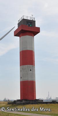
Port entrance light.
Description of the lighthouse.
 e.
e.
Maasvlakte lighthouse.
Description of the lighthouse.